Satellite-Powered Due Diligence: Transforming Land Compliance
Environmental sustainability has become a critical concern amidst increasing global regulation. Businesses are increasingly looking for simple yet sophisticated technology solutions to meet compliance standards.
Keeping up with all these green rules can feel like trying to solve a Rubik’s Cube blindfolded, WEME Earth here’s to help.
AI (Artificial Intelligence) powered satellite technology streamlines compliance, providing precision agriculture and transparent supply chain solutions with minimal effort.
We handle the complexity, ensuring your business stays compliant and builds credibility without the headache of managing administrative tasks. We’re like your trusty sidekick in the superhero movie of environmental responsibility, protecting your brand and profit.
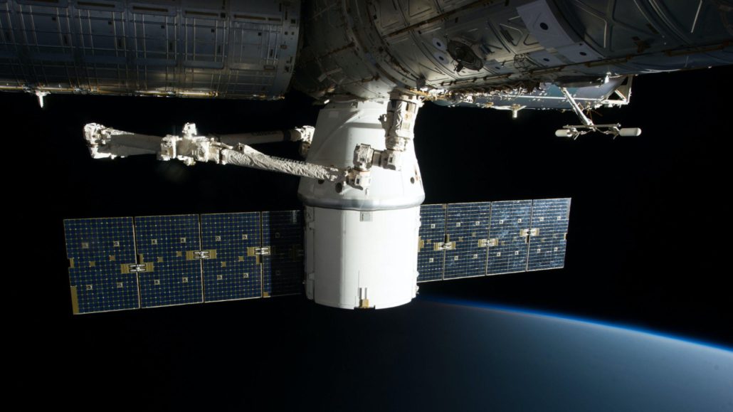
To meet compliance requirements related to deforestation, such as EUDR, companies must lean toward satellite data to provide evidence of their compliance. This Technology also allows to monitor additional key metric such as plant health and fertilizer requirements, returning substential return on investment.
This technology is revolutionizing the way businesses monitor their supply chains, enabling responsible sourcing and simplifying the due diligence process.
Who knew that staring at Earth from space could actually make things on the ground so much clearer?
Satellite-Powered Due Diligence for EUDR Compliance
A revolutionary change in European Union Deforestation Regulation (EUDR) deforestation compliance management and sustainable supply chains is transforming the traceability of agricultural commodities.
Integrating advanced satellite imagery for automated deforestation screening and farm monitoring will pave the way for digital supply chain transparency.
Companies can meet stringent regulatory requirements and utilize the tool to redue harvesting risk, lower usage of water and fertilzers, while promoting sustainability around the world, especially in the farming community.
Agricultural sustainability programs will continue to evolve to meet new global standards.
Accurate data is critical not only for farm-level data collection and supply chain mapping but also to avoid penalties, ensure uninterrupted EU market access, and maintain compliance with deforestation regulations for exports to the EU Member States.
Although this data is open source and accessible, it often lacks the precision and depth needed for EUDR compliance. Especially in identifying critical operational risks and opportunities.
Think of it as having a map of the world drawn with a thick marker – you get the general idea, but the details are a bit fuzzy.
Exclusive deforestation-related analysis offers increased resolution, precise land use change detection, and real-time crop health tracking. Then minimize the possibility of false positives and negatives.
The Evolution of Land Compliance
In the agricultural sector, sustainable supply chain management is becoming a cornerstone practice for modern businesses. Turns out, how we grow our food and make our products increasingly actually matters to consumers.
Companies are now required to comply with sustainable practices for their supply chains due to the increasing global awareness of strict regulations and global awareness of environmental issues.
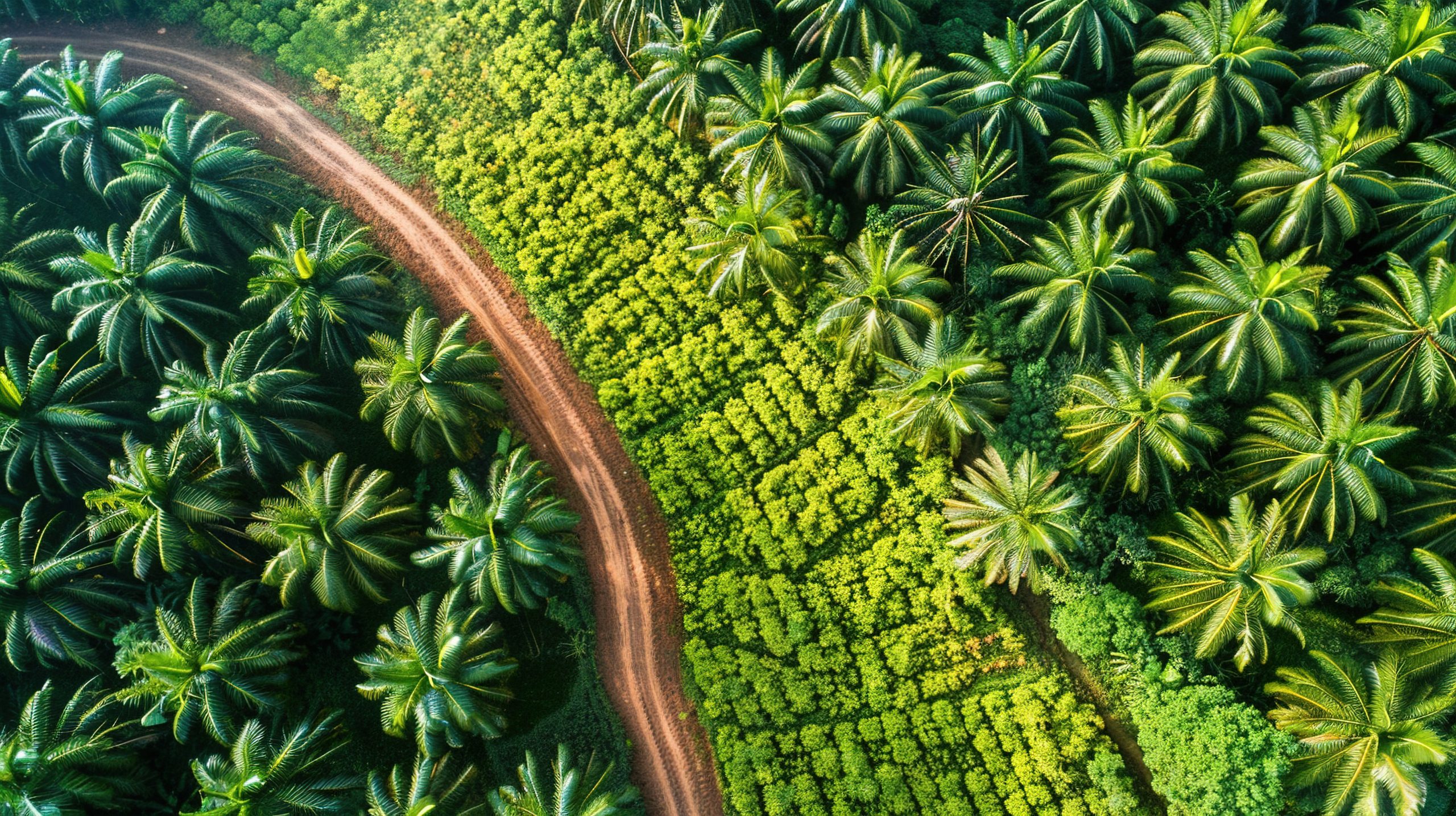
This evolution is especially evident in the palm oil industry, where demand for products is environmentally friendly and ethically sourced. The palm oil folks have certainly been in the spotlight, trying to show their greener side.
The European Union Deforestation Regulation (EUDR) is a game changer in this landscape, ensuring Exporters remain having access to the EU Market.
The law says that crops including coffee, cocoa, soya, rubber, lumber, livestock, and palm oil sent into the EU must follow deforestation free sourcing and manufacturing.
In addition, it must provide verifiable evidence that the product was produced without causing deforestation. Basically, if your product’s arrival in the EU involved a chainsaw, you can just turn around now.
However, this requires advanced technology solutions to ensure compliance while maintaining an efficient supply chain. Revolutionizing sustainable supply chain management at scale requires AI-powered satellite monitoring.
Allowing to overcome the challenges of regulations and policies, may they be national laws or other global sustainability standards for agricultural businesses.
It’s like using a cheat code for environmental compliance, but for the good of the planet, of course.
Traditional Due Diligence Challenge
There is now a compliance challenge that companies must provide evidence that their products are not linked to deforestation.
This is especially true for industries that rely on commodities such as soy, rubber and palm oil and the challenges associated with forest degradation.
Simply put, if a product is a cause of deforestation, it shall not reach EU shelves. Using satellite monitoring, businesses can track land use in real-time from space, providing a holistic view of the sourcing area.
Stakeholders along the entire supply chain from seeding to production are now able to effectively monitor land use and forest cover change with satellite data.
It’s like having a neighborhood watch, but the neighborhood is the entire planet, and the watchmen are in orbit.
The technology will provide a high-resolution view of land across the globe. Empowering companies to verify whether suppliers are operating in areas where deforestation is occurring.
Using satellites, models are built to empower plantations and natural vegetation. This monitoring will reveal the location of plantations and data providers on the extent of these crops.
So companies can verify whether their supplies come from recently cleared land and are in compliance with environmental regulations. No more trying to hide a rogue plantation behind a cleverly placed cloud.
Companies and regulatory bodies globally can pinpoint the exact location of suppliers and assess the area for deforestation. Using satellite data is a leap forward in transparency.
Visibility drives corporate responsibility and aligns business practices with environmental sustainability. For global trade, the evolution towards satellite-based supply chain monitoring has broader implications.
It’s nudging everyone to be a bit more honest about their environmental footprint. So there needs to be a new standard that forces companies to reconsider their sourcing strategies and invest in sustainable practices.
The Need for Digital Transformation
Agricultural sustainability is an important focus area, especially with increasingly stringent regulatory frameworks, such as the EUDR.
What needs to be done is to anticipate the increasing demand for supply chains and stricter requirements for transparency and sustainability. Some of the key trends shaping the future include:
- Increasing blockchain integration aimed at improving traceability
- Improving precision farming techniques to optimize resource
- The importance of carbon footprint monitoring, especially in agriculture
- Greater collaboration between agricultural stakeholders and technology providers
- Expansion of sustainability practices to more agricultural commodities. Basically, if it comes from the Earth, we’re going to be keeping a closer eye on it.
Traditional vs AI-Based Satellite Monitoring
There are several differences between traditional satellite analysis and AI-powered satellites.
- Accuracy: Traditional satellites have an accuracy of around 70-80%, while AI-based satellites have an accuracy of 95-99%. That extra 15-29% accuracy is the difference between “maybe there’s a problem” and “yep, definitely a problem.
- Coverage Area: Traditional satellites have a limited coverage area to the accessible areas. Then for AI satellites, global coverage through satellite imagery.
- Cost Effectiveness: Labor and travel costs in traditional monitoring are high, while for AI-powered satellite monitoring, operational costs are significantly reduced.
Less boots on the ground means more money in your pocket, and fewer muddy footprints.
- Data Collection Time: The next difference is in data collection time because traditional monitoring takes weeks to months. But for AI satellites, it is real time.
- Real-Time Updates: Traditional monitoring rarely has real-time updates or is often out of date, but with AI satellites monitoring, is continuous and up-to-date.
Waiting weeks for data in this day and age? That’s like waiting for snail mail.
- Compliance Readiness: Traditional satellites use manual checks that are prone to errors. Then for AI-based monitoring, automatic compliance is driven by AI.
Impact of Satellite Technology
The presence of artificial intelligence (AI) and automation has revolutionized procurement practices in the agricultural sector.
In addition to increasing labor efficiency, these resources also change the way companies conduct land compliance and due diligence. The presence of these AI-based resources provides benefits including the following:
- Increased accuracy in detecting inappropriate practices
- Reduced audition errors when conducting compliance checks
- Process data faster in both small and large amounts
- Improve decision making based on real-time interviews
- Cost-effective monitoring of geographic areas, both large and small
By utilizing AI-based technology, companies can maintain tight control over their supply chains.
In addition, it can significantly reduce the resources and time required for compliance checks.

Not only related to compliance, but AI technology can also empower stakeholders throughout the supply chain.
To ensure product traceability, tools are available to collaborate effectively. This will provide convenience for agronomists, suppliers, and field staff. Finally, technology that actually makes everyone’s lives a little bit easier
- Agronomists: Empowering real-time access to crop health data and AI-powered insights to make better decisions.
- Suppliers: Increased visibility into the supply chain, enabling proactive compliance management.
- Field Staff: Mobile devices for efficient farm monitoring and data collection.
- Farmers: Access to sustainability guidelines and advanced farming practices.
- Regulators: Transparent and verifiable data on supply chain movements and farming practices.
Modern Compliance Requirements
Sometimes businesses don’t have full visibility into their supply chain. Even worse. Manual tracking makes it like trying to meet a constantly changing target. Of course, this can be difficult to achieve.
Non-compliance can result in fines and reputational damage. Of course, this is unfortunate when it happens. Satellite monitoring systems can help better assess risks and provide quality transparency into compliance with EUDR requirements.
Nobody wants a hefty fine landing in their inbox – it’s bad for the bottom line and even worse for the planet’s PR.
More importantly, the use of satellite technology can verify that the product is sustainably sourced and does not harm the earth.. Even ensuring a deforestation-free supply chain.
1. Leveraging Historical Satellite Data for Strategic Planning
The role of historical satellite data is to understand deforestation patterns. Trend analysis over several years can be used to identify areas at risk.
It can also forecast future deforestation actions. This long-term study can assist businesses match their plans with EUDR compliance and sustainability objectives.
It’s like predicting future storms using previous weather patterns, except for forests. Historical data will reveal patterns over time. Naturally, this will facilitate locating areas for ongoing deforestation.
In addition, historical data is important for long-term strategic planning and proactive decision-making. For example, areas with active illegal logging activities can be targeted for stricter interventions.
Detailed satellite monitoring systems provide a historical analysis of deforestation. This will help companies assess environmental impacts over time.
This knowledge helps one to guarantee land compliance and grasp trends in relation to the EUDR criteria. From an environmental standpoint, seeing the larger picture allows everyone to make better decisions.
When businesses do multi-year studies, they may forecast possible environmental concerns and change their sourcing policies. This can enable them to more closely follow rules and even control their supply chain.
Knowing the past helps to inform and increase the dependability of future planning. Access to historical data helps to track land usage and show the sustainability of raw material sources.
Companies in commodities such as coffee, soy, and palm oil will be directly involved. Using monitoring tools for deforestation can validate land compliance with EUDR regulations.
It will also reduce the risks associated with the illegal use of free land. Less “oops, didn’t see that forest” moments, which is good for everyone.

2. Real-Time Deforestation Alerts and Immediate Action
Deforestation alerts use near-real-time satellite technology to quickly detect changes in forest cover.
These alerts notify businesses of deforestation activities in near real-time. This enables rapid response and helps prevent further environmental damage.
Think of it as a planetary smoke detector, but instead of smoke, it’s deforestation, and instead of a beep, it’s a notification.
Companies can better manage their supply chains by providing instant insight and ensuring land compliance with environmental standards.
3. High-Resolution Imagery Analysis
Using the right platform that is designed to seamlessly integrate with existing operations.
High-resolution satellite photos and data analysis help to improve forest risk analysis and modeling by identifying deforestation trends, evaluating forest health, and forecasting possible hazards.
It’s like moving from a hazy image to a crystal-clear IMAX vision of the woods of the planet.
The methodology helps businesses to identify locations with high risk of deforestation, hence guiding their energy sourcing and regulatory compliance decisions.
Satellite monitoring systems may detect many kinds of crops in the supply chain using high-resolution satellite photos, hence improving transparency and traceability.
This due diligence not only supports land compliance but also encourages sustainable agricultural practices. Being good to the Earth doesn’t have to be a headache; sometimes, it just takes the right technology.
4. Real-Time Monitoring Capabilities and Satellite Technologies
One of the most effective tools for ensuring compliance with environmental regulations and critical for businesses, especially those related to deforestation, is real-time satellite monitoring.
This technology allows regulators and companies to monitor forest areas continuously. In addition, they can monitor and respond quickly to any illegal deforestation activities.
To track forest cover changes as they occur, satellite technology is needed to monitor deforestation.
Often, conventional monitoring techniques depend on very ineffective field surveys. These techniques, meanwhile, are only good for a few days, weeks, or months.
This might cause delays in acting right away to combat illicit logging or other destructive activities.
But, real-time satellite monitoring using cutting-edge imaging technologies. Satellites may take thorough, ongoing pictures of forest regions.
This means that any deforestation activity will be detected immediately. This allows companies to take quick action to ensure EUDR compliance and reduce environmental impacts.
Today, various satellite technologies offer many benefits for monitoring deforestation. Here are some of them:
- Radar Satellites: Radar satellites can capture images despite poor light levels or weather conditions. They emit radio waves and measure the time it takes for them to bounce back.
This technology can provide data on forest density and structure. Satellite radar is very suitable for tropical areas and places where cloud cover often occurs.
Finally, a way to see through those pesky clouds that always seem to be hiding something.
- Optical Satellites: To capture visuals of the Earth’s surface, Optical satellites use visible light. This can produce high-resolution images, making it easier to identify changes in forest cover.
By combining these technologies, companies can achieve comprehensive forest area monitoring and can even maximize coverage and clarity.
5. Data Collection and Transparency in the Supply Chain
Efficient supplier data collection using satellite monitoring allows businesses to collect real-time and accurate data about source areas.
The integration of satellite data makes it easy for companies to verify whether suppliers are complying with deforestation and sustainability regulations, such as the EUDR.
It’s like choosing the well-behaved kids for your project group – less trouble down the line.
No more relying on a supplier’s vague assurances; now you’ve got satellite-backed proof. The use of automated tools such as APIs and secure links will simplify the process of providing relevant data.
This transparency then helps businesses monitor environmental risks, improve supply chain management, and ensure sourcing practices are fully traceable and deforestation-free.
With detailed deforestation insights available, businesses can implement proactive compliance strategies. This will involve adjusting supplier relationships and sourcing from areas with low deforestation risk.
Building a Verified Deforestation-Free Supply Chain
A supply chain that is deforestation-free requires a combination of audit verification steps and certification.
Deforestation-Free Sourcing Verification Steps
- Supplier Due Diligence: First, conduct background checks. Then ensure that the supplier has complied with sustainability policies.
- Geospatial Monitoring: Geospatial monitoring using satellite data so that deforestation can be tracked in real-time.
- Risk Mapping: Only work with suppliers who have proven compliance and identified high-risk areas. It’s like dating – you want to know their track record before you commit.
Third-Party Audits and Certifications
- Rainforest Alliance: Audits for sustainable farming practices.
- Forest Stewardship Council (FSC): Certifies paper and wood products.
- VSA or Certified Sourcing Areas: A New system that verifies deforestation-free sourcing for commodities like palm oil and soy.
False Deforestation Alerts
False deforestation alerts occur when satellite monitoring systems incorrectly identify changes in land cover as deforestation when no harmful or illegal activity is taking place.
This is because temporary changes such as seasonal vegetation changes, cloud cover, or human activities such as agriculture can mimic deforestation in satellite imagery.
These false alerts can help flag areas that require further investigation, but they can also lead to unnecessary monitoring or costly verification processes for companies, especially those seeking to maintain compliance with regulations such as the EUDR.
Stakeholder collaboration can also help reduce impacts on forests. Companies can avoid regulatory sanctions by using real-time and historical satellite data and can even contribute to sustainable land management.
Working together makes the whole “saving the planet” thing a lot less daunting.
The Future of Sustainable Agriculture
AI-powered satellite monitoring technology is not just about compliance; it is also a catalyst for positive change in the agriculture sector.
These innovative solutions will ensure businesses can meet regulatory requirements and contribute to global sustainability efforts.
It’s not just about avoiding the stick; there’s a pretty big carrot of a sustainable future dangling out there. The future of agriculture is powered by cutting-edge technology that supports efficiency, transparency, and environmental management.
By complying with EU deforestation compliance, reducing compliance and regulatory costs, and revolutionizing sustainable supply chains, it becomes an investment in a more sustainable and prosperous agricultural future around the world.
So, embracing these high-tech tools isn’t just good for the planet; it’s also pretty smart business.
WEME Earth, Integrating Satellite Solutions into Daily Business Operations
WEME leverages cutting-edge AI-powered satellite technology for precision agriculture and sustainable supply solutions.
This enables businesses to operate more optimally, ensure EUDR compliance, monitor crop health, improve supply chain efficiency, and support ESG goals.
WEME focuses on industries such as hydropower and agriculture. The service helps companies measure and monitor ESG performance related to deforestation and climate change.
WEME’s solution allows for an ‘emotions out, facts in’ approach, providing fact-based and objective insights into operations to help make decisions that are aligned with regulatory and sustainability requirements.
We’re all about the data, no room for guesswork when the planet’s at stake.
WEME’s due diligence intelligence reports are audit-ready and integrate directly into EU information systems, helping businesses protect their reputations and track land compliance.
At WEME Earth, we use advanced satellite technology to help smallholder farmers, agricultural traders, and multinational agricultural companies improve their operations.
AI-powered satellite systems will collect real-time data to make agricultural management more efficient, including optimal crop performance. Think of it as giving every farmer their own personal satellite assistant.
WEME Earth Services
WEME Earth Services monitors sustainable supply chain solutions.
1. Optimizing the Supply Chain
With the EUDR in effect, businesses must ensure a deforestation-free supply chain. WEME Earth helps achieve EUDR compliance by leveraging satellite imagery.
This satellite will conduct deforestation risk analysis and assist in sustainable supply chain solutions. We’re like the ultimate matchmaker, connecting businesses with deforestation-free supply chains.
2. Transforming Farming Operations
WEME satellite technology provides high-resolution agricultural imagery for land mapping, soil analysis, and crop health monitoring.
Be it for coffee, cocoa, soybean, rubber, or oil palm farming. This service helps minimize chemical use, reduce costs, and increase yields. Precision farming solutions will support better decision-making.
So that it can lead to the best sustainability solutions and higher returns on investment.
WEME technology helps businesses to eliminate the complexity of traditional methods. Such as expert satellite interpretation and drone operations.
Why spend hours squinting at satellite images when our AI can do the heavy lifting for you?
By using this technology, it can ensure cost-effective and more optimal operations for sustainability.
3. Smart Operations
WEME helps in the precise monitoring of irrigation needs, crop density, and fertilization requirements through satellite imagery.
It then enables the prediction of pests and diseases in order to measure and optimize agricultural productivity sustainably. Think of it as having a crystal ball for your crops, predicting potential problems before they even sprout.
By leveraging autonomous satellite monitoring, WEME reduces environmental impact while enhancing operational efficiency and supporting compliance with international sustainability frameworks.
In addition, it supports the commitment to a deforestation-free supply chain. This technology can manage EUDR compliance and contribute to global sustainability standards.
Integrating the WEME Earth Platform into Business Operations
The WEME Earth Platform functions as a dynamic hub that will facilitate communication between stakeholders.
The centralized space is not only a place to store all reports but also a versatile environment for easy access to reports for clients. It’s like your very own mission control for environmental compliance.
This platform also offers the convenience of exploring a variety of reports that are accurate on WEME Earth.
Users involved will get a comprehensive experience and various conveniences.
WEME helps reimagine the way of operating and utilizes new tools to develop processes and overcome business challenges. We’re not just offering a service; we’re offering a whole new way of thinking about sustainability.
With expertise in geoscience and space technology, WEME can identify the most relevant insights for the business.
It can even be transformed into intelligence for business planning and decision-making.
WEME Earth Performance
WEME collaborates with a wide network of Earth Observation data providers and geoscience experts to become a one-stop shop for clients and suppliers.
For accurate, data-driven decision-making, use the WEME Earth platform. With this platform, you can improve daily business operations and how WEME Earth services work:
- Identify Needs: WEME transforms project requirements into precise technical specifications that ensure a clear understanding of the information sought to meet business needs.
- Subscribe to the WEME Earth platform: This platform will simplify the communication process and offer easy access to analysis presented in an easy-to-use format.
Think of it as getting the VIP pass to environmental insights.
- Identify Data Sources: The data sources and external experts needed are determined to carry out comprehensive analysis and generate reports.
This platform involves all experts and suppliers smoothly for end-to-end project management.
- Data Analysis: Raw data collected from various sources is analyzed by a team working with external experts.
They will extract meaningful insights and then translate them into actionable information by including data in the analysis.
- Preparing Reports: Reports on the WEME Earth platform are easily accessible, which will provide specific insights into the project.
- Accessing Reports: Accessing reports through WEME Earth is very easy and can explain the various other reports available on the platform. Navigating our platform is easier than finding your favorite streaming show.
WEME’s unique approach supports Social, Environmental, and Governance (ESG) objectives, focusing on providing audit-ready Due Diligence Intelligence (DDI) reports.
Reports can be directly uploaded to European Union Information systems and shared with EU regulatory bodies.
WEME Earth ensures your business is not just compliant but also future-ready.
FAQ
1. How does satellite-based due diligence address land compliance in today’s regulatory environment?
Satellite technology provides real-time, accurate monitoring of land use, helping companies verify deforestation-free sourcing and meet EU regulations with automated, transparent compliance reports.
2. Can AI improve satellite monitoring?
By increasing accuracy (up to 95-99%), providing real-time updates, automating compliance checks, and reducing operational costs, AI can improve satellite monitoring
3. What is the European Union Deforestation Directive (EUDR)?
The EUDR requires companies to ensure that agricultural commodities such as coffee, cocoa, soy, rubber, timber, cattle, and palm oil imported into the EU are not linked to deforestation. This is certainly a step towards a greener earth